
![]()


Topography in Beitou
Beitou is the northernmost of the twelve districts of Taipei city. And it is located on the southwestern side of Datun Volcano Group in Yangmingshan National Park. Surrounded by Mt. Datun, Mt. Qising and Mt. Shamao, Beitou stands far apart facing Danshui River.
The landform of Beitou is getting low from northeast to southwest. The highest spot is Mt. Qising which altitude is 1120 meter. The lowest spot is Guandu Nature Park. Most hills have a slope over 30 verticality. Parts of plains are located in the south of Zhongyang N. Rd., the west of Zhongyang S. Rd. and the Shipai area.
Bibliography: Zeng Xian-Hui
![]()
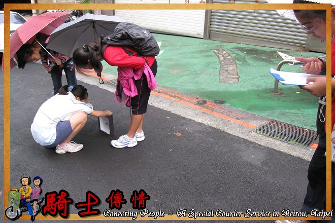
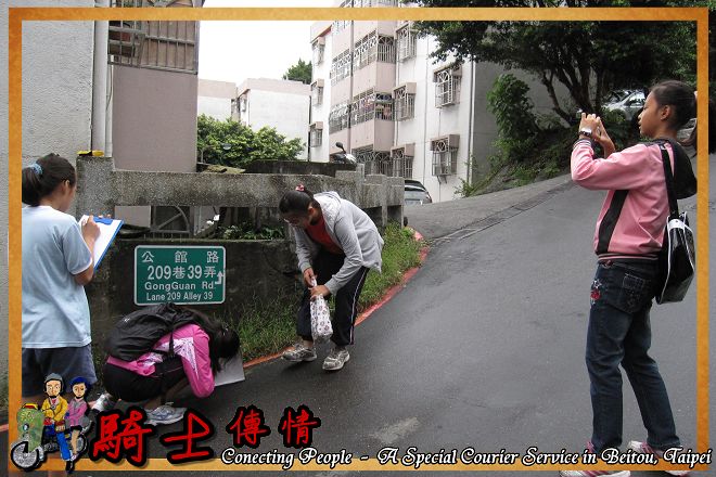
Measuring topographical slope
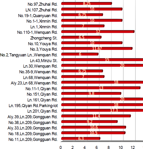
The most tilted section: Ln.161,Qiyan Rd. and Ln.30, Wenquan Rd.
The sconf tilted section: Parking-lot in Ln.195,Qiyan Rd. and Aly.23,Ln 68,Wenquan Rd.
The third tilted section: Ln.201,Qiyan Rd.
|
Measurement sections |
Measurement results |
Average |
|
No.18,Ln.209,Gongguan Rd. |
12、10、9、11 |
10.5 |
|
Aly.39,Ln.209,Gongguan Rd. |
6、12、14、13、12 |
11. |
|
Ln.201,Qiyan Rd. |
9、19、19、20、15、22 |
17.3 |
|
Ln.161,Qiyan Rd. |
15、25、15、30、15、 |
20 |
|
No.11-1,Qiyan Rd. |
20、5、10、10、20 |
13 |
|
Aly.23,Ln 68,Wenquan Rd. |
18、15、22、17、 |
18 |
|
Ln.30,Wenquan Rd. |
5、25、15、30、25 |
20 |
|
Ln.43,Minzu St. |
15、10、25、10、 |
15 |
|
No.2,Tangyuan Ln.,Wenquan Rd. |
6、6、7、5 |
6 |
|
No.3,Youya Rd. |
11、12、12 |
11.67 |
|
Zhongzheng St. |
7、6、5、8 |
6.5 |
|
No.110-1,Wenquan Rd. |
12、12、11、13 |
12 |
|
No.1-1,Xinmin Rd. |
11、10、9 |
10 |
|
No.19-1,Quanyuan Rd. |
6、7、9、5 |
6.75 |
|
LN.107,Zhuhai Rd. |
10、11、10、9 |
10 |
![]()
![]()